|
This is my absolutely favorite time of year when only three things consume my mind - heat, thunderstorms and Noctilucent Clouds. April had been quite a cold month with below average temperatures mixed with a few convective opportunities including hail and even late season transient snow showers and numerous mammatus displays. However towards the end of the month high pressure moved in bringing a splendid period of sunny dry weather. It was one of those delightful periods when it was dry day after day and sunny with blue skies, the kind of weather we all dream of which never seemed to end. It so happened that during this period I was spending a lot of time drone filming at the north coast, actually I was doing a job which involved a lot of flying but also a lot of watching of certain areas waiting on movement, as a result I got hours of exposure to the elements for days on end and ended up with an early season tan, the weather was very warm at times and to be honest I was absolutely buzzing, after all, who doesn't like being under the sun, it makes you feel so good.
On the fourth day, April 28th, the job ended early and I found myself on the north coast with time on my hands so I decided to spend that time wisely and do do my own kind of filming. I didn't really know what to look for, I was on alert for gorse fires but I never got any however I did notice that the rapeseed fields this time of year were looking stunning so I decided to include these into my filming adventure. Instead of going home my usual route via Coleraine I ventured west towards Ballerina then took a random drive into the Myroe area, I was exploring, enjoying the scenery, and looking for photo opportunities.
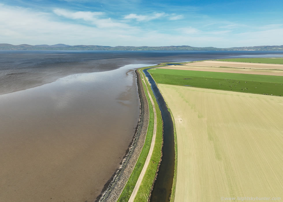 |
I was driving following my instincts and ended up at the shore of Lough Foyle, the sun was blazing in a blue sky and the wind was dead calm, it was the perfect day. I got the drone up for a look, check out this beautiful flat landscape, so dry yet so fertile, Lough Foyle on the left and farm land on the right with Co. Donegal straight ahead.
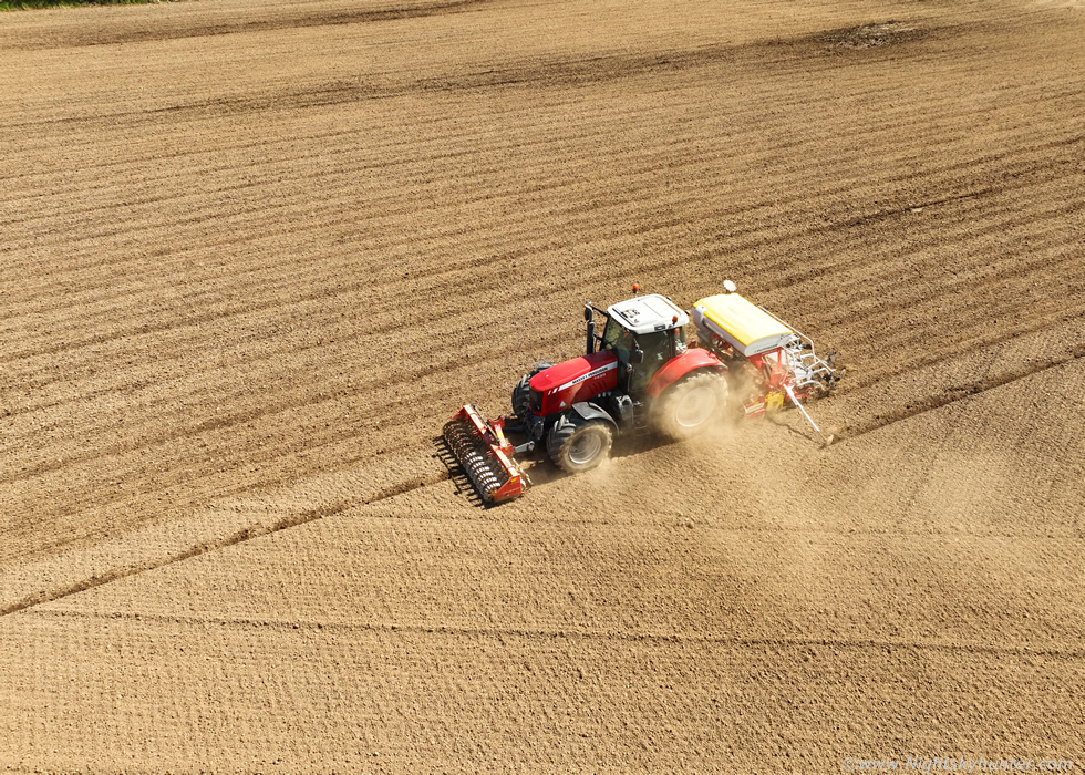 |
Numerous tractors where at work in the fields, it was a busy day, I dropped the drone down for a closer look to record footage. It was so dry plumes of dust and field debris were lofted into the air, it was a scene more like Kansas than N. Ireland.
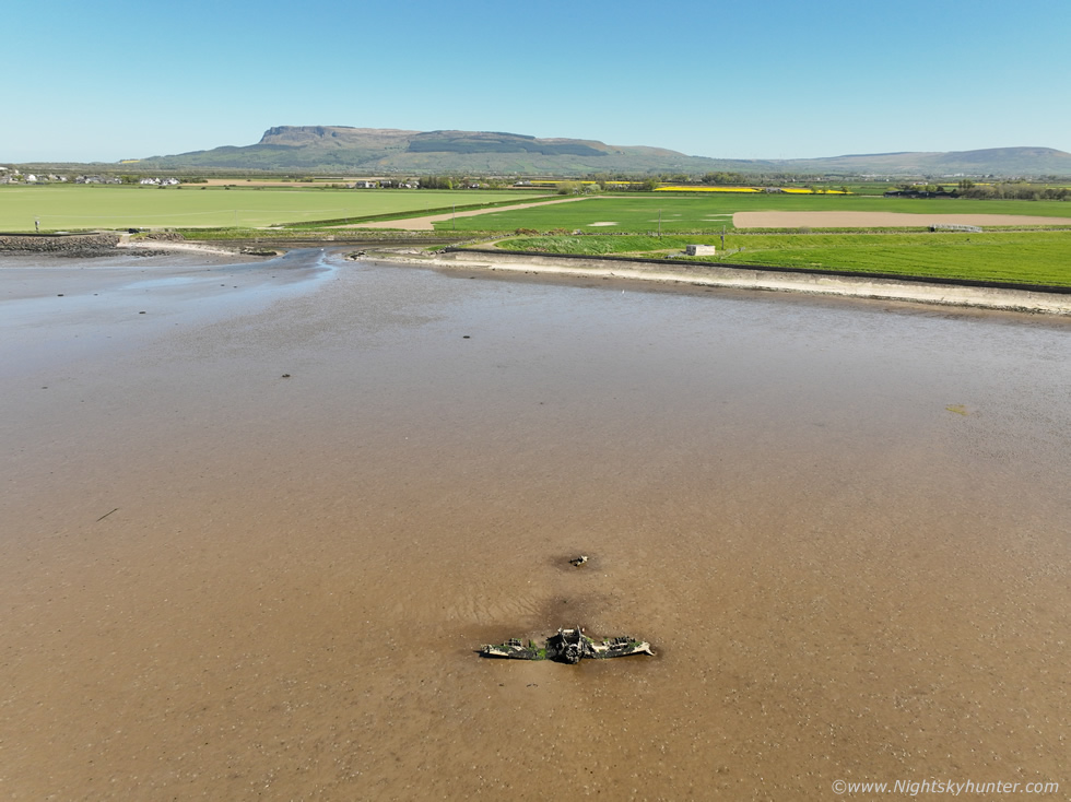 |
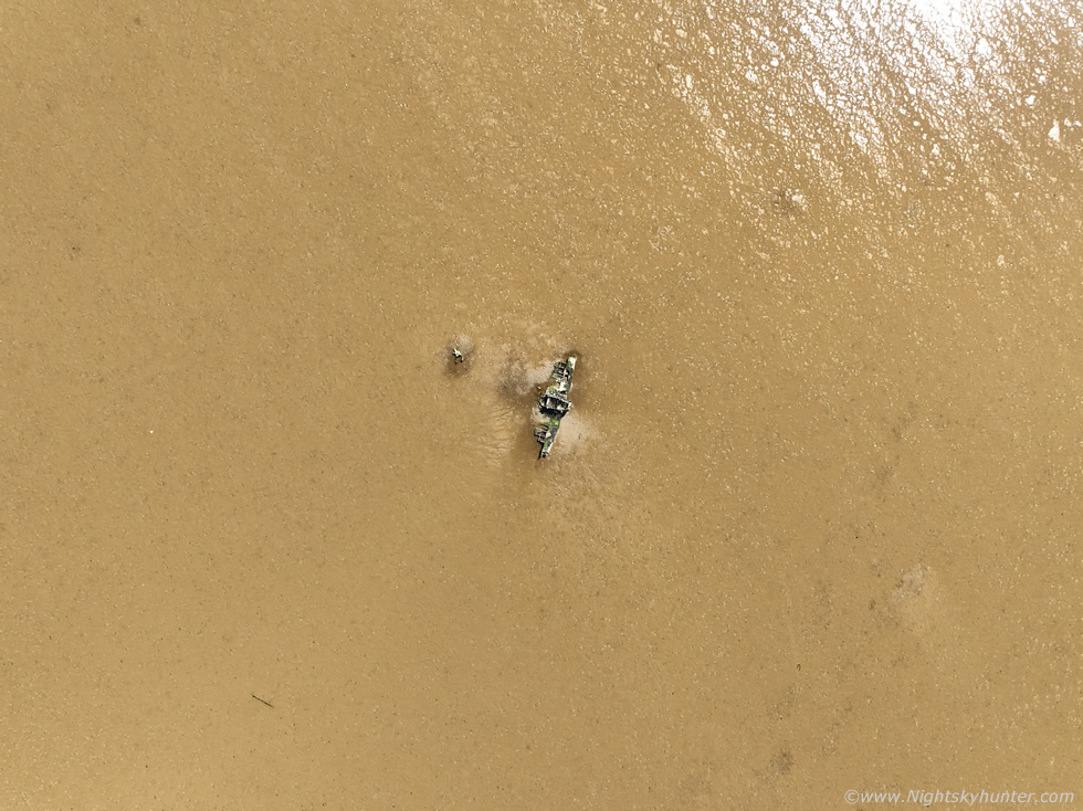
By pure random luck it was low tide, so low the lough had virtually vanished from the shore exposing vast expanses of wet mud flats, and there, completely in view, was a subject I have always wanted to film but for some reason or another never got around to it. I'm sure some of you have seen images of the World War II fighter plane/bomber ruins in the Foyle, I have too and have always wanted to tick it off my list and here I was by pure happenstance and the plane was staring me in the face. It didn't even look that far from shore, perhaps a couple of hundred meters, I could have walked out to it however I had no wellies and besides the mud flats can be dangerous, anyway this is exactly what drones were made for so I flew out for a look. View of the plane and Binevenagh mountain in the distance.
The incident took place on October 9th 1944, it was a routine flight from RAF Eglington however the American built aircraft suffered an abrupt engine failure. '' The Canadian pilot, Sub-Lieutenant Charles Henry Schwenger, managed to ditch the plane safely on the mudflats near Ballykelly and walked ashore''. The plane is a Vought Corsair, the pilot survived but was injured, due to the suction danger from the mud the wreckage was never removed and can still be seen to this day at low tide.
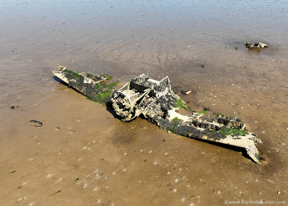 |
My timing couldn't have been better, I didn't plan this at all, the tide was completely out exposing the entire plane. It was actually quite amazing to see this plane and surreal to think it was a fighter plane from WWII, a true relic and time capsule from that era and I had the luxury of staying dry on shore thanks to the drone.
 |
This became the highlight of my day, it was after mid afternoon and I decided I may as well make my way home. However as I navigated the narrow country roads I was blown away my the wonderful landscape there and the random rapeseed fields so I couldn't resist getting a few images.
 |
I pulled over at the side of the road in the Myroe area and got the DSLR out with the wide angle lens for a few images. I love these fields, the yellow colours were incredibly vibrant under the high afternoon sun and contrasted perfectly against the clean blue sky. I continued driving home and somewhere outside Limavady I spotted another stunning rapeseed field in my wing mirror behind me across the road and beyond, it was so cool looking I had to suddenly pull over near a gate to a field and got the drone out.
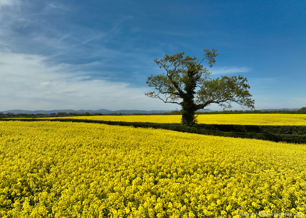 |
Several acres of yellow rapeseed seemed to possess and unearthly glow with a bright intensity beyond description, the fields in which they grew were curved with ridges adding to the majesty of the landscape, and there all on it's own, was a single tree in the middle of it all. I love isolated trees in fields, they make for great subjects, I didn't want to walk into the field, it was private property and I didn't want to damage crops, I just flew the drone over. It was now a breezy day with 10-15mph gusts swaying the crops while my controller presented the usual high wind warning icons.
I lowered the drone down until it was a foot or so from the rapeseed to isolate the tree against the blue sky as much as possible and got several images, almost at head height using a DSLR, after all a drone is a tool, it doesn't need to be flying high, think of it just as a camera you can place at any angle and elevation. I ended up filming nice video sequences here smoothly flying over the fields and wrapping around the trees, I was loving it. Content with the footage I landed and began driving back home to end the day.
 |
It was now May, a month which has always been good to me for many years both for warm weather and for storms, however the month began on an uninspiring note. The skies were devoid of anything interesting and temperatures were suppressed. Paul Martin and I met for an unexpected chase on the hills near Omagh, I can't recall the date off hand, it was a day of cloud cover issues, low CAPE but very strong shear. We witnessed a distant cell to our W with a developing shelf cloud, my Dad rang to say they had a lightning storm over Belleek in Co. Fermanagh, turned out that was the very same cell we were observing. Then the rain arrived and stayed over for us for hours with no structure, however we did get a rumble of thunder inside the rain.
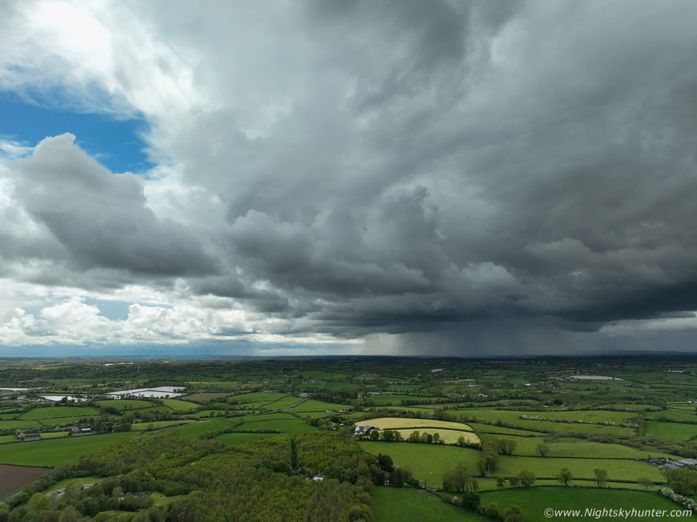
Then by mid month, May 15th, after what seemed like an eternity a convective opportunity appeared. It was far from remarkable and instability wasn't as high as I was used to for the time of year. CAPE values of 600j/kg with higher resolution models indicating pockets of 800 CAPE. The flow began SWly then veered Wly for late afternoon, shear was none existent so cells would be unorganised pulse storms yet with -30c tops several storms were forecast. Several target areas where on offer yet the E and SE of N. Ireland looked best, I chose Co. Armagh as models suggested strong cores there later in the day. The biggest draw back was cloud cover and lack of solar heating which could completely kill any potential. Roisin, Ella and I spent the entire day in Armagh watching and waiting. We were impressed to experience excellent solar heating, more than I had expected, however I noticed the convection was not responding as hoped for. A radar check showed showers over Co. Fermanagh with red cores slowly moving E towards the Armagh area so these became our target. We re-located to Navan Fort and got on the top of the famous fort offering an excellent view of the entire sky, it was late in the afternoon and there was our target in sight approaching from the W.
The clouds were dark and brooding, the lead cell ahead of a cluster had arrived slowly making a bee line for us, moving towards the camera and to the right at the same time in this image. Radar indicated red cores and visually a nice growing precip core was on view. For a time I was convinced this was turning into a storm and was expecting a rumble at any moment however all was quiet and soon the warm afternoon turned cool as the outflow arrived and it was time to take cover. We just made it back in time as the core arrived bringing heavy rain. We ended the chase and drove back home and the entire journey was under rain. When I got back I found out there had been a thunderstorm south of Lough Neagh over Portadown and it was obvious from radar that the cell we got at Armagh was the same storm, it had been developing the entire time. So although we didn't get any thunder we at least did get the early stage of that storm forming. The storm of the day happened over Co. Down over the Bangor area later in the day, a strong thunderstorm matured dropping a spectacular hail core, the images which appeared on social media later were stunning. The roads and beaches were white as if a layer of snow had fallen in January, however this was caused by hail stones!, there was even hail piled up in drifts against doorways, it really was impressive, I would have loved to have seen that.
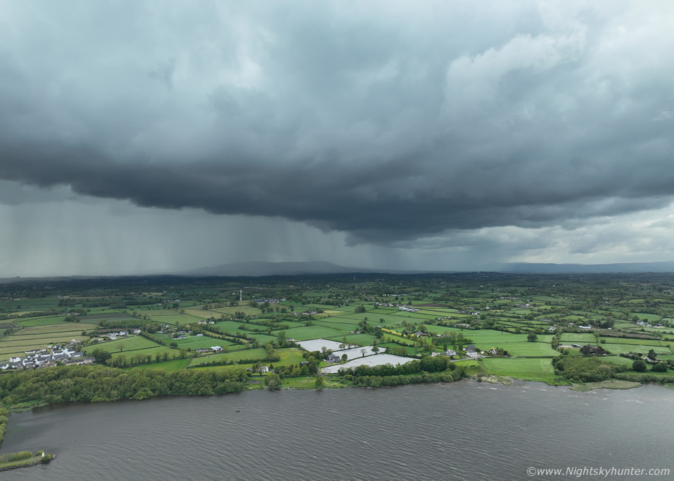
May 17th was the next proper set-up, -30c tops, only 20 knots of wind shear but this was off-set by the surface flow so actual shear was weak, a day of pulse storms. However with convergence, deep moisture, humid air, it looked like storms were much more likely with stronger updraughts, it was more typical of a warm season chase day. The only concern was cloud cover suppressing heating, I studied every chart I could to try and pick a target area, this is the most difficult part of chasing, especially when shear is weaker and models show variance on where storms are likely. Since it was a Sly flow veering SWly later I expected the E/SE and NE of the country to be best, even more so as warm air aloft was moving in by late afternoon and the remaining upper cool pool would be over the E of the country. My main targets where Ballymena, Ballymoney or general E. Antrim areas, also Belfast Lough, N and S looked promising. However by morning the models also indicated Tyrone and the Lough Neagh area had potential too and since the lough was a closer target area which offered excellent views to the E that became my target. I held back for as long as I could to gather intel then after midday Ella and I headed out.
We arrived on the NW shore of Lough Neagh, I got logged on to wifi and did a radar check, things had developed rapidly since I had left the house only half an hour earlier. There were no sferics plotted anywhere in the country yet however red cores had appeared and it looked like cells where now forming behind the morning occlusion as expected. I noticed a slanted line of red cores over Tyrone moving N/NE and if they held together they would arrive at the lough within 30 min's. Ella and I went for a walk, I brought the gear just in case, the air felt very mild and calm, and humid, which actually felt like a storm day, the lough flies were thick and a bit of a nightmare, I was hoping for a breeze to clear them away soon. Ten minutes later I spotted the SE end of that convective line passing over the SW of the lough, the tops looked crisp but perhaps a little short, the base was low and things looked promising. The NW end of the line suddenly appeared above the tree tops behind us, the sky looked dark and menacing and heavy rain could be seen falling already, this thing was moving fast.
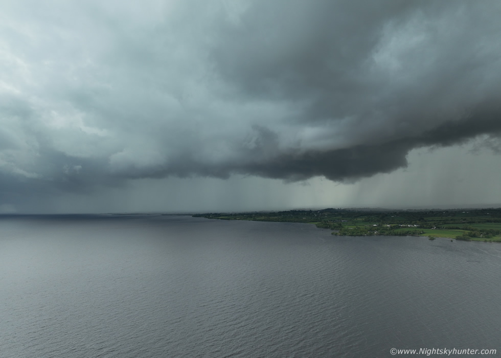 |
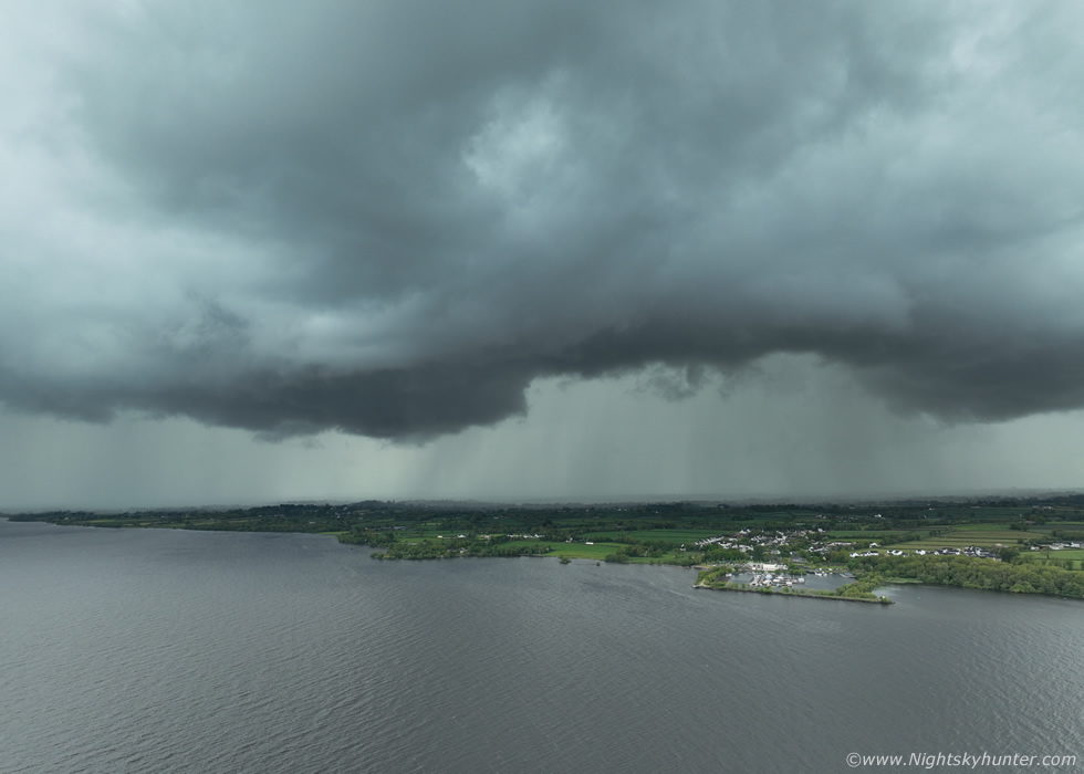
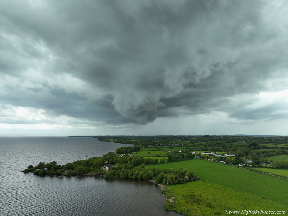
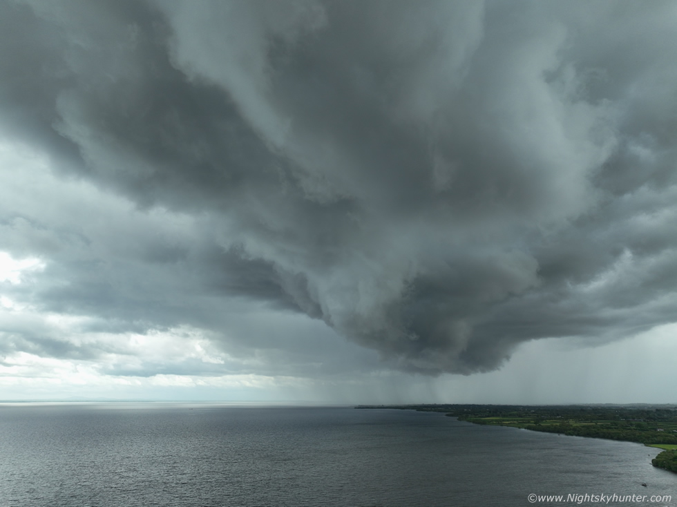
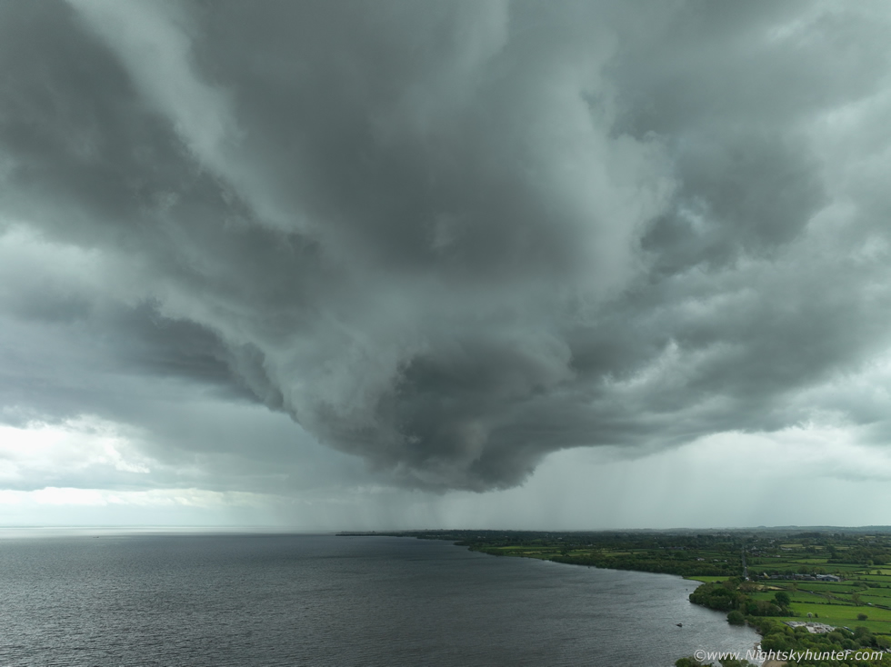
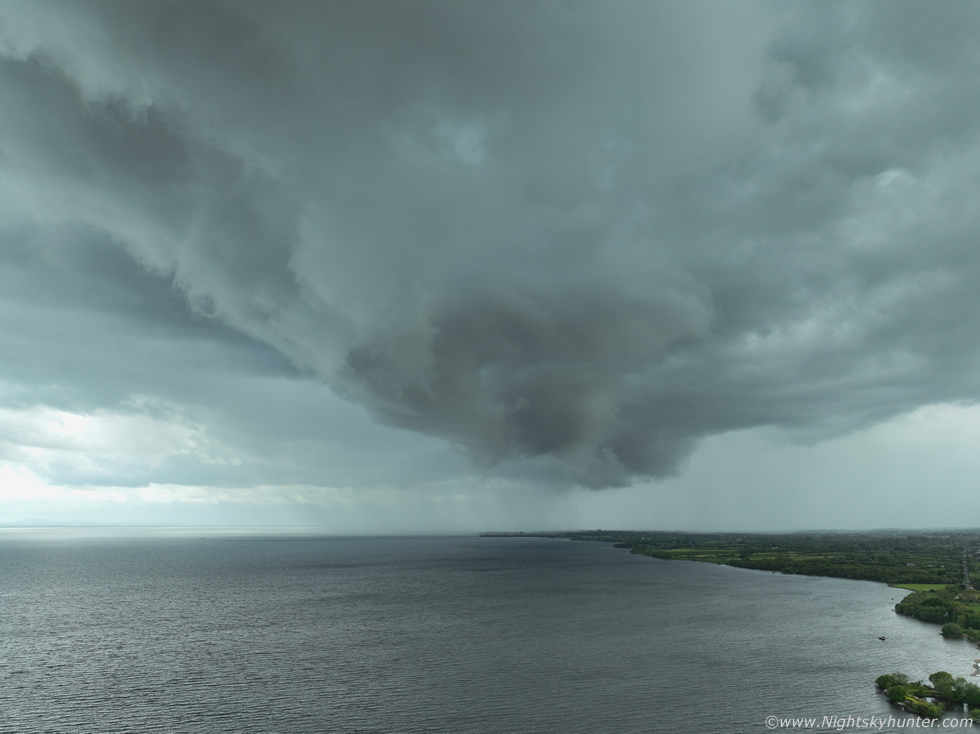
I rushed like mad to get the drone in the air so I could see over the trees and get a proper look, I had an issue with the drone which delayed filming and the cell line was almost on me, I was beginning to think I would get no images at all if the problem continued, then I got it sorted, drone up, then panned around to face the W/SW. Big line spanning the entire W side of the lough advancing fast with what looked like multiple gust front regions, this was the W portion half way across the line, the clouds were low and very dark visually with an even darker lowering, the actual lower portions of the cloud were darker than shown here. I began shooting still images and recording 4k video sequences, I didn't have long and could sense a strong precip core was going to get us soon.
 |
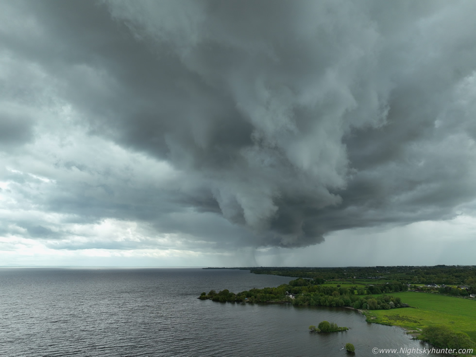
Drone out over the lough looking back towards Ballyronan Marina with curved gust front with bases either side. It looked the part, in fact, I was shocked there was no thunder, this looked like a thunderstorm yet it was quiet, but I could sense the change in the atmosphere, it felt like a bolt could strike at any moment so I stayed in the air for as long as possible.
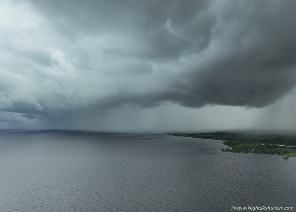 |
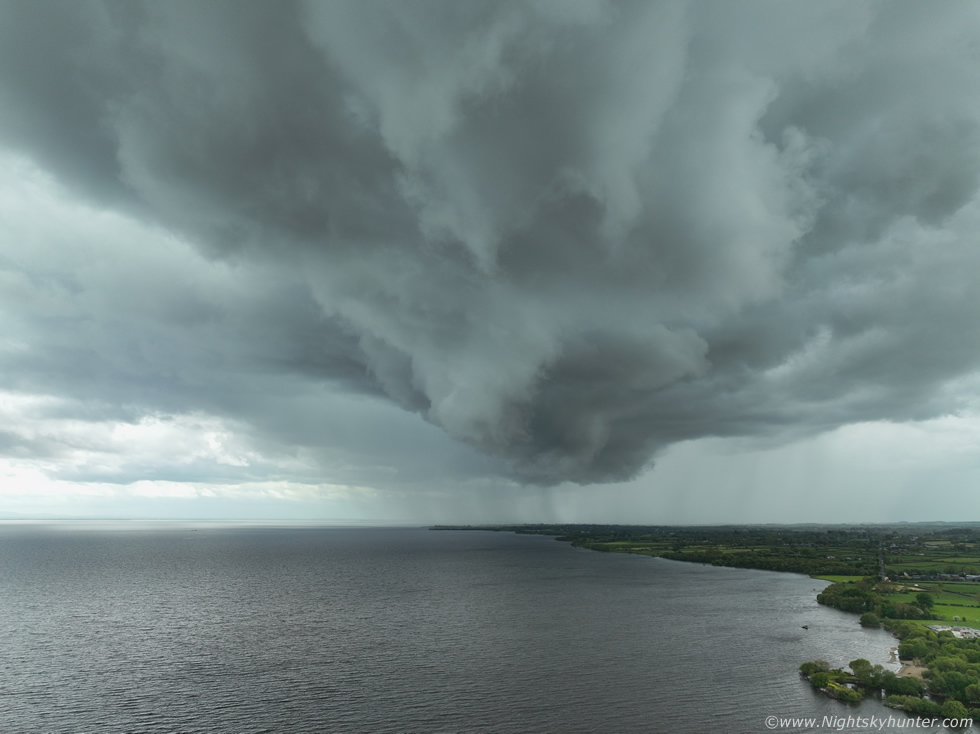
SW portion of the line, this is wide angle and a lot closer than it looks here, in reality every instinct was telling me to get the drone back now and land and pack it away in case it got the drenching of it's life but I stayed in the air trying to get every capture of the evolving gust front and the hope that lightning was about to strike, the sky was mean looking and I was loving it.
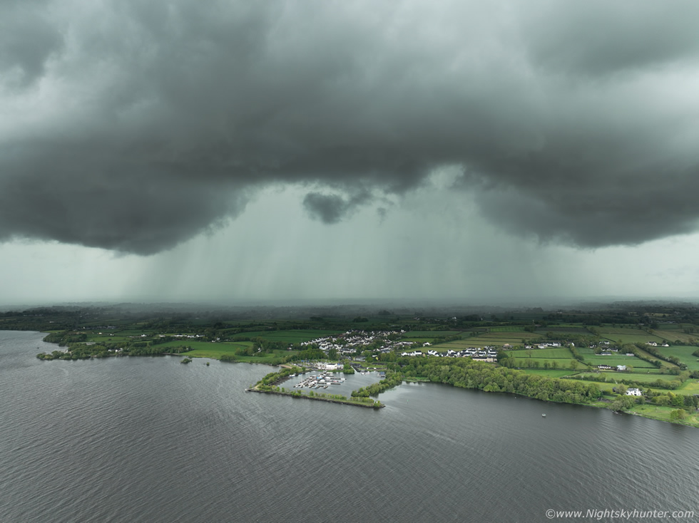 |
Savage storm clouds, compare the size of the buildings and boats at Ballyronan to the storm clouds above for a sense of scale, and this actual line extended far left and right out of frame. Interesting structure here with the swollen lowered bases either side of the guster, I've only ever seen this once before and it reminded me of August 13th 2008 (report). When you see these dark clouds with gust front structures repeating more than once on a chase day then you know you are going to be dealing with high precip cells/storms with dominating outflow features, nature always sends a hint early in the day, if you are seeing this now then expect more of the same later, perhaps even stronger, in which case always stay ahead of advancing cells/lines.
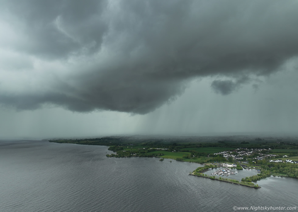 |
Love the lowered region, I didn't notice any rotation however it was definitely the base of a cell along the leading edge. This was extremely close!, you can't appreciate it from the wide image but on the ground this dense silver-grey wall of rain was rite behind the trees at my back, I could feel the dampness in the air and the cold gust front spreading across the surface bringing gusty winds, I knew I had waited too long, I would never make it back to the van in time and the drone was still in the air 300m away over the water and Ella was now on edge, she sensed something was coming, well at least the flies were gone.
The rain began to fall just as I was bringing the drone in to land, it got absolutely drenched!, Ella and I then rain through the rain to the van, it was only 150m or so distance but it felt like running forever and in slow motion through that rain, talk about a deluge, normally Ella needs some coaxing to get back inside but this time when I opened the door she jumped rite in, she doesn't like getting wet. Then we listened to the hammering of the rain on the roof, I was soaked rite through all layers of clothing so I had to change clothes and get warmed up then we watched the cell pass into the distance. 15 min's later it was dry again and the clouds vanished then a large clear sector moved in from the SW bringing clear skies and excellent solar heating.
I bumped into photographer John O'Neill who was also watching for storms so we teamed up for the day. It was a perfect afternoon with strong sunshine, it seemed everything was on our side and the solar heating was significantly better than what the models had showed. There was still no lightning anywhere in the country which was concerning, however things can and often do suddenly change later. We spotted a cluster on radar slowly moving in our direction and this became our main target of the day. It wasn't so much a line as an irregular cluster peppered with red cores but it was moving into a zone of better instability and colder tops coinciding close to maximum surface heating and the legendary five o'clock magic in chasing folklore. After what seemed like a substantial wait the sky darkened behind us as the cluster approached so we moved to a better viewing angle.
 |
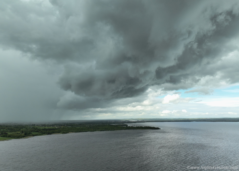
Then the cluster came into view but by now it had turned into a line, it covered a good portion of the W side of the lough, this was facing W towards Slieve Gallion. Yet again it felt like thunder was about to happen, it was in the air, but so far no sparks. John and I continued to watch it near as it developed a gust front/shelf feature.
 |
The gust front suddenly came into view and the S end formed very interesting structure with big chunky rounded lowerings as a portion of the shelf lowered, this was facing S/SW.
 |
Structure of the day as the leading edge of the shelf slowly passed over our heads
 |
Full wide angle, John was shooting away with the DSLR beside me, if nothing else happened this day I would be more than content with this for today's catch. Moving R to L here.
 |
It actually looked like it was organizing more and the precip behind the lowering in the distance was getting stronger. Overhead the clouds were slowly swirling and lifting upwards as the cooler outflow air undercut the warm moist air ahead, even though we knew it was the gust front region we were on alert for brief spin ups and funnels.
 |
N side, there was a lot of motion going on up there.
 |
Decent structure and to be honest far better than anything I was expecting this day
 |
The rain arrived so John and I got back in the cars for shelter, radar showed that the line was strengthening fast with a line of red cores over the lough with whites forming. Suddenly I heard a rumble of thunder over the lough behind a wall of rain, then a little later a perfect pink cloud to ground positive bolt struck over Antrim on the other side of the lough, first thunder of the day for me and actually my first sighting of a c-g this season. This storm really pepped up over E. Antrim producing a lot of lightning and decent structure all the way over land and out to the North Channel where it was still flashing. This became the storm of the day in N. Ireland so at least we watched it grow from the lough. Things wound down after this and the day was over. To be honest I was happy with what I got, I'm a structure guy so I will take this in the meantime, after all the Summer is young yet.
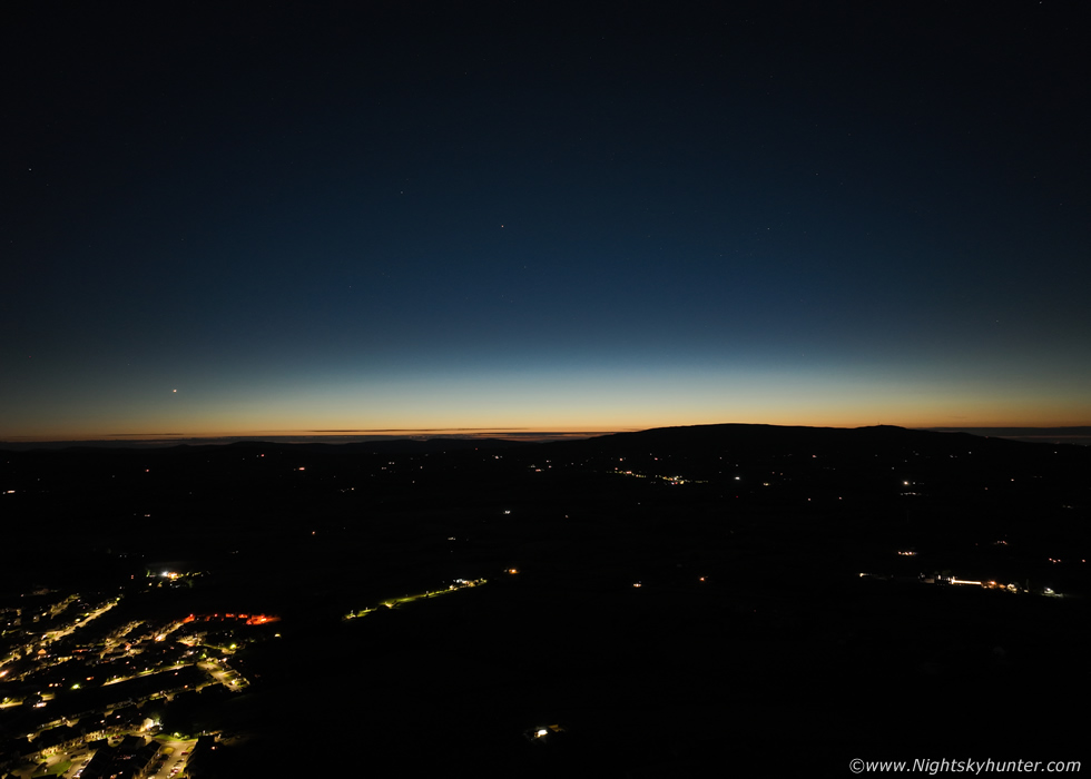 |
It's late May and we are back in another glorious spell of high pressure weather with warm temperatures and great sunshine, as I write this today it could reach 24C in N. Ireland, perhaps hotter, in the Republic it has surpassed 28C. It's now the 2026 NLC season, the window period covers late May to early August with the best shows during June and July so the early season displays tend to be extremely weak and unimpressive, however there's great satisfaction to be had spotting these early displays to hone the observing skills and adjust the body clock to stay up late on Summer nights. May 24th/25th was perfectly clear and just one of those classic Summer nights with lingering twilight glow and not a breath of wind.
I put the drone up in the air for a look and took a few exposures in manual mode before midnight facing N/NW, Venus is the bright star to the left and Capella can be seen upper centre. I couldn't see this low down due to horizon obstructions so I was relying on what the drone screen was showing me. In my 26 years of experience with NLC observing I'm reasonably sure I can see subtle type 1 brightness Veil structure, which looks like a white amphorous horizontal glow due N and slightly higher than the altitude of Venus. This may entirely be an atmospheric affect however I have seen faint veil NLCs before which take on this appearance, the sighting remains unconfirmed, but in any event it's great to be back to this time of year and I look forward to seeing what this season has to offer.
The storm situation for late May is looking on a knife edge at the moment, in one hand we have big energy showing (1000 to 3000 CAPE) however we are lacking a trigger and at the moment the cap might win. At the time of writing there's a low chance a shortwave could trigger showers and isolated strong thunderstorms on either Wednesday (27th) or Thursday (28th), if it does do anything interesting I will be covering it on here. Thanks very much for reading.
Martin McKenna